
Global product
Landfill Watch
Territorial detection, monitoring and prioritization across large areas.
A site-level assessment framework that establishes a transparent local baseline for planning restoration, productive reuse or Nature-based Solution pathways.
The Local Drone Assessment turns drone orthophotos and point clouds into an expert-reviewed site baseline: an interpreted waste footprint, local reference surface, volume evidence and transparent screening scenarios.
Discuss a site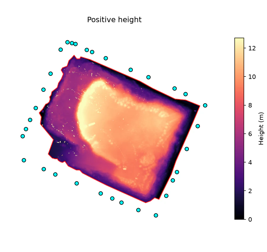
Landfill Watch shows where to look. L2NbS Framework defines what to do next.
Landfill Watch identifies and prioritizes suspected landfill sites across large territories. The L2NbS Framework translates selected sites into field-based assessment, restoration scenarios and long-term monitoring indicators.
Global product
Territorial detection, monitoring and prioritization across large areas.
Local product
Assessment and transformation planning for a selected site.
The framework brings spatial evidence, field inspection and local context into one site-level assessment process.
Assess site conditions using spatial analysis and UAV-supported field inspection.
Select restoration, productive-reuse or utilization scenarios.
Identify environmental risks, constraints and local opportunities.
Define indicators for long-term site monitoring.
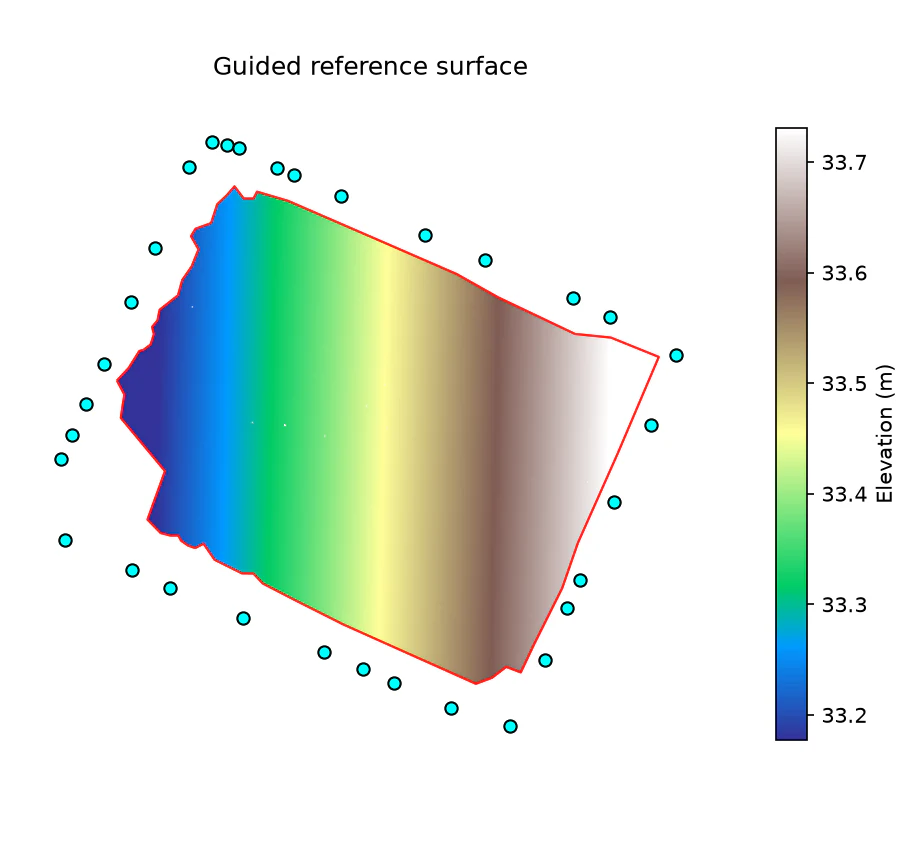
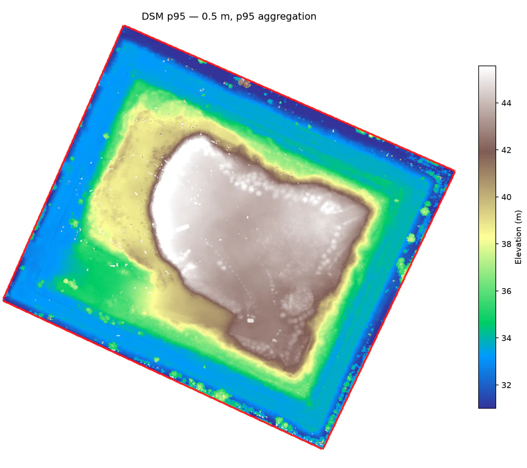
The assessment combines a drone orthophoto and LAS point cloud with an expert-interpreted boundary and local reference points. It links the current surface, fitted reference surface and positive height inside the reviewed footprint.
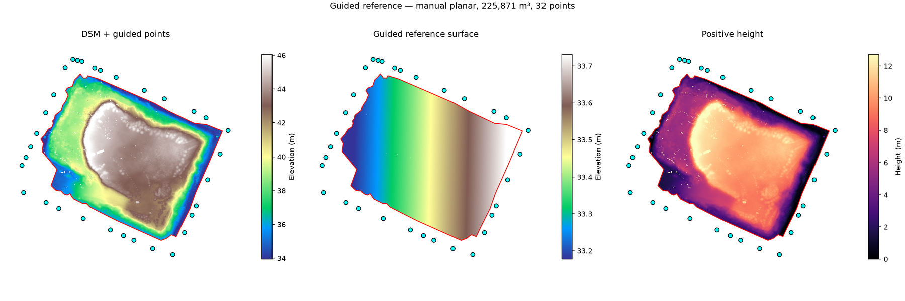
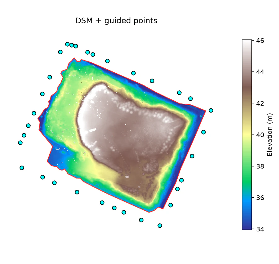
Use the drone orthophoto as visual context and aggregate the LAS point cloud into a site-level digital surface model. In the example report, the preferred DSM uses p95 aggregation at 0.5-metre resolution.
An expert interprets the waste boundary and places local reference points on stable road, perimeter and surrounding ground surfaces.
Fit a planar reference surface, calculate positive height inside the reviewed boundary and apply a height cap to reduce spike influence.
Report site geometry, validate vertical alignment and explore assumption-based waste-mass and methane-potential ranges alongside QA and limitations.
These values illustrate a single manual expert-reviewed assessment. They are site-specific outputs, not general product-performance benchmarks.
Geometry and QA outputs establish the site baseline. Composition and methane-potential views explore explicit assumptions; they do not identify materials or measure emissions.
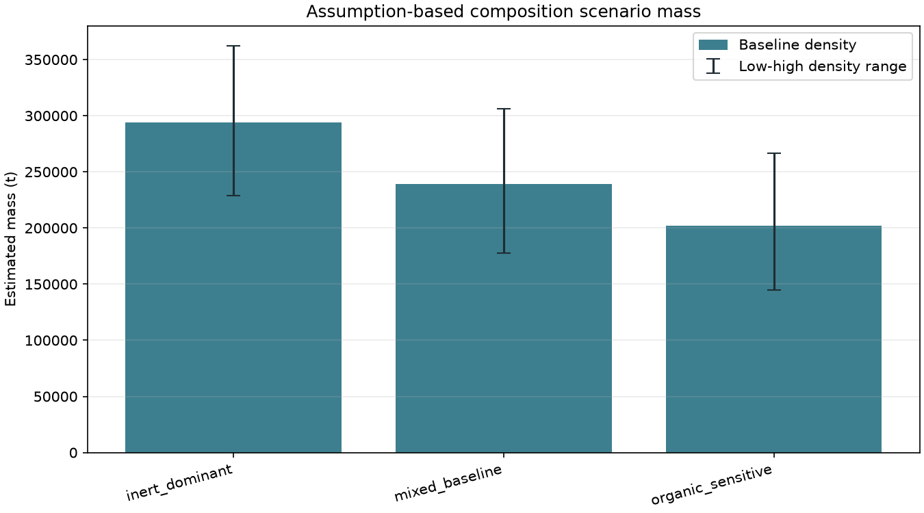
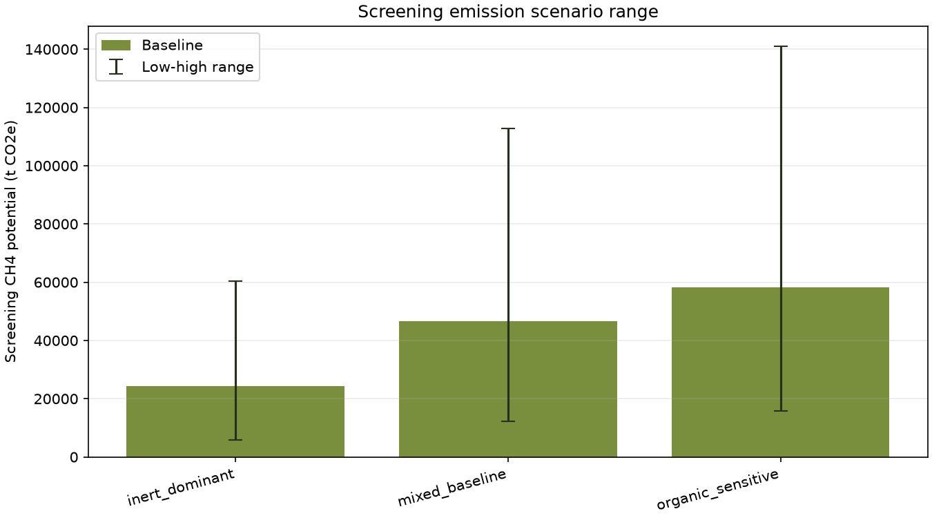
These ranges use configurable composition, density and methane-potential assumptions; they are not measured composition or emissions.
| Scenario | Estimated mass range | Methane-potential range |
|---|---|---|
| Inert dominant | 228,695–361,959 t | 5,752–60,475 t CO₂e |
| Mixed baseline | 177,874–306,056 t | 12,325–112,844 t CO₂e |
| Organic sensitive | 144,558–266,528 t | 15,753–140,896 t CO₂e |
Identification and prioritization establish where to focus. Validation and transformation planning define the pathway for a selected site.
Use Earth observation data, AI and contextual layers to identify sites for review.
Prioritize sites by risk, feasibility and decision relevance.
Confirm site conditions with field evidence and local knowledge.
Define restoration, reuse or Nature-based Solution pathways with stakeholders.
Bring spatial analysis, field evidence and local knowledge together to evaluate restoration, productive reuse or Nature-based Solution pathways and establish indicators for long-term monitoring.